Wednesday, June 5, 2013

Atlantic City, NJ

After looking at the weather reports yesterday in Cape May, we all decide to venture out and head for Atlantic City. We were the last of 7 as we needed fuel. By the time we got underway about 1030 the winds had died down and the seas were only 1-2'. It was a pleasant ride staying between 3/4 and 1 mile offshore.


Coast Guard Station Cape May


 Ocean City, NJ


Atlantic City


Charis in the slip.
New friends, Rick & Leila Minnis aboard Sun Gypsy

Tuesday, June 4, 2013

Check-in/OK message from SPOT Charis

Charis
Latitude:39.37786
Longitude:-74.42706
GPS location Date/Time:06/04/2013 16:15:59 EDT

Message:This is a SPOT Check-in/OK message. Ken & Ann are fine and having fun!

Click the link below to see where I am located.
http://fms.ws/CK9kg/39.37786N/74.42706W

If the above link does not work, try this link:
http://maps.google.com/maps?f=q&hl=en&geocode=&q=39.37786,-74.42706&ll=39.37786,-74.42706&ie=UTF8&z=12&om=1

Charis

You have received this message because Charis has added you to their SPOT contact list.

Ready for Adventure
FindMeSPOT.com

Monday, June 3, 2013

Cape May, NJ

Yesterday we spent wandering around this quaint old town of Cape May. We took the historic district trolley tour and learned a lot. The main section of town burned in the great fire of 1878 so all the homes in that area were rebuilt since then. Cape May has the largest concentration of Victorian structures outside of San Francisco.


There are over 600 Victorian historic homes.

Here are a few shots of the marina, Utsch's, pronounced Utches.


One street in town is a walking street with lots of shops and a few surprises from the past.


We had dinner at the Lobster House last night which was fabulous! Today, Mon., it has rained all day. we did laundry and some engine room chores. The winds offshore look like they will turn in a westerly direction tomorrow so we'll head to Atlantic City.


Sunday, June 2, 2013

Another day in Delaware City then on to Cape May

We were primed and ready to leave at 6 am Fri. morning. The waterway that the marina in Delaware City is very narrow and has a very swift current through it. The dock is very long down one side of it. Either upon arriving or departing, they have to spin the boat around so you are facing the Delaware river for departure. We were the first boat to arrive Thur. and I elected to dock in the direction of arrival. Everyone else coming in spun around as they arrived. No problem, I just had to be spun on departure. That said it was done and the staff is very skilled with using the current to do this. When we were facing the right direction and clear of the dock, the bow line was tossed to the boat. The problem was it didn't land on the boat but rather the water and we were drifting backwards with the current and the line and the bow thruster met. The thruster lost and quit. So we returned to the dock and spent another day. I did manage to get several maintenance items taken care of. Since it was Ann's birthday we decided to have dinner at the only full service restaurant Crabby Dick's. John and Barbara Albright from GO joined us and we had a wonderful time.

Ann with her birthday cake.


 A closer shot.

Ken getting a weather briefing from Tim the marina owner.


The trip down the Delaware river and bay were not as nice as the previous days runs but not uncomfortable. Winds picked up to about 15 kts and seas were choppy at 2'. We had the current with us a good bit of the time and pulled into Cape May at about 1245. The are 5 or 6 other looper boats here also. The AGLCA has a harbor host here which are volunteers that help other loopers. Rich and Carol Nick invited all of us to their home for cocktails at 330 pm and even picked us up. It was a great time meeting and talking to others.


Departing Delaware City


Ann encounter with a freighter in the ships channel. Note the red hull through the windshield.


Ship John Shoal light.

The Cape May to Lewes ferry just inside the Cape May canal. It decided to leave just as we were entering the canal.


Rich and Carol Nick


The group at the Nick's.


After the get together we had Rich drop us off at Cview restaurant for dinner with John and Barbara. Great food! We walked back to the marina and got a small glimpse of the area. It looks like the weather will be keeping us here for a while.

 John and Barbara

We couldn't get near here on Sat. night but will try another day. Great seafood store where we can stock up on fresh fish.

Saturday, June 1, 2013

Check-in/OK message from SPOT Charis

Charis
Latitude:38.95111
Longitude:-74.90582
GPS location Date/Time:06/01/2013 12:56:48 EDT

Message:This is a SPOT Check-in/OK message. Ken & Ann are fine and having fun!

Click the link below to see where I am located.
http://fms.ws/CHaSa/38.95111N/74.90582W

If the above link does not work, try this link:
http://maps.google.com/maps?f=q&hl=en&geocode=&q=38.95111,-74.90582&ll=38.95111,-74.90582&ie=UTF8&z=12&om=1

Charis

You have received this message because Charis has added you to their SPOT contact list.

Ready for Adventure
FindMeSPOT.com

Friday, May 31, 2013

Worton Creek to Chesapeake City, no, Delaware City

We left Worton Creek Thur. morning in what was another beautiful day. Planned a short 3.5 - 4 hour trip to Chesapeake City. Again the bay was flat as a lake and light winds. We were again making over 8 knots with the current. Here are some shots of the shoreline in the northern bay.


Here is a manufactured park with a view!


As we approached the C&D (Chesapeake & Delaware) canal we heard a radio broadcast that the canal was closed because they were stretching cables across it. We proceeded on and just as we got to the entrance they open it for 20 minutes. We still had the current with us and it was early so we decided to continue on to Delaware City on the other end.

 Chesapeake City.

 A railroad lift bridge.

Delaware City is a nice stop. The town is very small but Tim and staff at the marina are great. We had a 5:15 meeting with Tim to discuss the weather in the bay for departure tomorrow and decided to head out. Ann wants to spend her birthday in Cape May, NJ.
 The Delaware City Marina.

 In the hotel.

The main street!

Thursday, May 30, 2013

Annapolis to Worton Creek

We woke up yesterday in Annapolis to a beautiful sunrise.


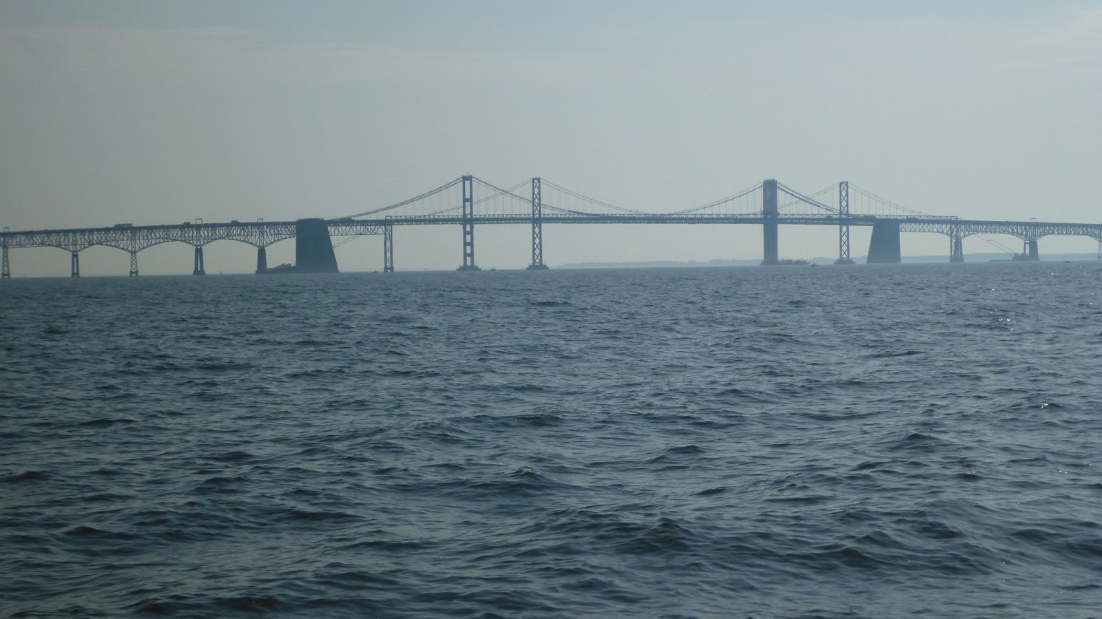
The trip to Worton Creek on the eastern shore couldn't have been better. Almost flat water and light winds. We had the current behind us most of the way. Leaving Annapolis you pass by the Naval Academy and later cross under the Chesapeake bay bridge.


Really cruising at 9.0 kts. with the    current!
Wharf at Handy's Creek. No phone & no internet.


Planning for tomorrow.


Check-in/OK message from SPOT Charis

Charis
Latitude:39.57179
Longitude:-75.59023
GPS location Date/Time:05/30/2013 13:12:11 EDT

Message:This is a SPOT Check-in/OK message. Ken & Ann are fine and having fun!

Click the link below to see where I am located.
http://fms.ws/CG0LT/39.57179N/75.59023W

If the above link does not work, try this link:
http://maps.google.com/maps?f=q&hl=en&geocode=&q=39.57179,-75.59023&ll=39.57179,-75.59023&ie=UTF8&z=12&om=1

Charis

You have received this message because Charis has added you to their SPOT contact list.

Ready for Adventure
FindMeSPOT.com

Wednesday, May 29, 2013

Check-in/OK message from SPOT Charis

Charis
Latitude:39.28162
Longitude:-76.16959
GPS location Date/Time:05/29/2013 13:09:41 EDT

Message:This is a SPOT Check-in/OK message. Ken & Ann are fine and having fun!

Click the link below to see where I am located.
http://fms.ws/CFBgA/39.28162N/76.16959W

If the above link does not work, try this link:
http://maps.google.com/maps?f=q&hl=en&geocode=&q=39.28162,-76.16959&ll=39.28162,-76.16959&ie=UTF8&z=12&om=1

Charis

You have received this message because Charis has added you to their SPOT contact list.

Ready for Adventure
FindMeSPOT.com